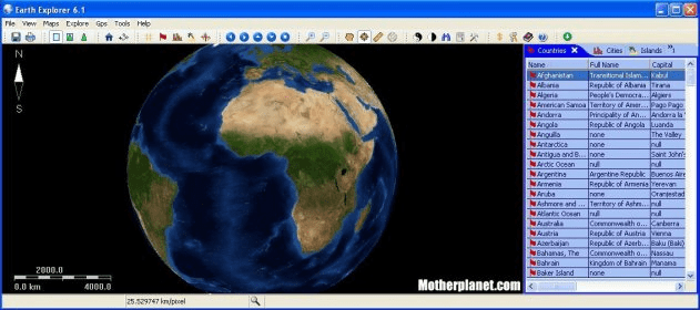
Earth Explorer 3.5 integrates 1km resolution resolution satellite imagery with some map layers such as political boundaries, coastlines, rivers, lake and island boundaries, 267 countries and regions, 40000+ ranked cities, 15000+ islands, and 1700+ noteworthy historical earthquakes since 1980 into a fantastic 3D earth globe. You can config the view to show the map what you like, rotate and explore the globe, read and learn the geographic information provide on the globe, etc.

A fantastically realistic 3D model of Earth with great educational content!


Comments